Previous Page
The Hougaard Fork ATV Trail
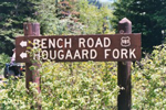 The Hougaard Fork trail is another leg of the Arapeen OHV trail network. It is located approximately 10 miles up Manti Canyon. From the trail head you will also have the choice to ride the Bench Road. We rode the Hougaard Fork trail in mid June, which seemed to be a great time. At the beginning of the trail you have to cross a small stream. This is the same stream that forms the Milky Falls so the run off determines its difficulty. This trail is just a gradual climb, no major hills or obstacles for the first several miles. Because it was so early in the year when we did this trail there was a lot of water and snow melt all along it, so we got muddy. Approximately 4 miles up the trail it forks, you can continue north or east both are tagged trail 33.
Mineral Fork ATV Trail - Big Cottonwood Canyon
 The Mineral Fork Trail is the last ATV trail up Big Cottonwood Canyon. This trail is projected to be closed, so before you ride this trail check with the Wasatch - Cache National Forest Service to be sure the trail is still open. The trail head is approx 6.5 miles up Big Cottonwood Canyon. The parking area just appears to be a large pull out on the side of the canyon road. How you know your in the right area is to look for a large metal gate on what appears to be a private road. As you can see by the picture above, there is not much room for parking. If you arrive at this trail and see several trucks with trailers, you may want to ride this trail another day.
6 Ways to Escape the Winter Blues
 We all know that familiar feeling that hits sometime mid-January—the winter blues. The holidays are over, the weather is cold, and the snow seems unrelenting. The best cure? To embrace the winter, not wish it away. Try some of the activities below and create your own antidote to winter restlessness. Take a hike the winter way, with snowshoeing at one of many locations along the Wasatch Front. The Sundance Nordic Center provides 15 kilometers of groomed cross-country ski trails that are great for novices and experienced trekkers alike. Rent snowshoes on site, enjoy the trails, and stop by one of the award-winning restaurants before heading home.
Forest Lake ATV Trail #194
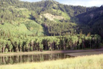 Mineral Basin trail #194 has to be one of my favorite ATV trails. The trail head is approx 3.3 miles up the Mineral Basin main trail. The first part of the trail requires you to drive through a stream. The first mile of this trail is very rough with large boulders and very deep ruts. In fact a four wheel drive ATV is very nice on this trail. It has been torn up; not by ATV'ers but by big 4X4's, rock crawlers etc. Once you get through the lower part of the trail the rest is still very rocky but it only has a few sections with deep ruts.
Lower Major Evans ATV Trail #295
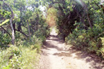 Trail 295 begins approx 3.0 miles up the Mineral Basin road. The trail starts right off with a little challenging rock outcrop. As soon as you get passed that the trail levels out, and you start making your way through groves of quaken aspens. About a quarter of a mile up the trail you will come to a sign that marks Grave Yard Flat. The trail also forks at this point. You can continue up the mountain, or take the other fork that takes you down a steep rocky trail back to the Mineral Basin main road. We stayed on 295 which headed up the mountain.
Burnt Hill Road (ATV Trail)
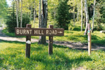 Located approximately 9 miles up Manti Canyon. Burnt Hill is the start or end of a couple different trails. Some are jeep and 4X4 accessible, while others are for four wheelers only. Burnt Hill is trail #32 on the Arapeen OHV trail system. We started are trip at the Burnt Hill turn off headed down towards town. Approximately 3 miles into the trail it split and becomes trail #34 commonly referred to by the locals as Pole Haven, or continues down and hooks into trail #3 which takes you to the mouth of Manti Canyon and the Patton Trail staging area.
Knolls Recreation Area
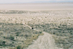 Located just off of I-80 in Utah's west desert is the Knolls Recreation Area. With nearly 36,000 acres of sand dunes, hills, and mud flats, this place is the perfect OHV play area. The dunes are not as large as Jericho but just as fun. If your looking for speed the mud flats are the place, you can drive long distances on these flats and rarely feel a bump. For a casual ride you can explore the many Knolls which the area is named after.
Little Sahara Recreation Area
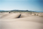 Little Sahara Recreation Area commonly known as Jericho Sand Dunes, is a sandy reminder of Lake Bonneville. A plentiful sand source and strong prevailing winds have combined to create Little Sahara, one of the largest dunes fields found in Utah. Most of the sand at Little Sahara is the result of deposits left by the Sevier River, which once flowed into ancient Lake Bonneville some 15,000 years ago. After the lake receded, the southwesterly winds that flow across the Sevier Desert picked up the exposed sand. Sand Mountain, in the middle of the dune field, deflected the wind upward, causing it to slow and drop its load of sand. Sand particles, composed mostly of quartz, fell downwind among the sage brush and juniper around Sand Mountain, ultimately creating a 124-square-mile system of giant, free-moving, sand dunes.
Easter At Little Sahara Recreation Area
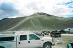 Easter weekend the family, friends and I decided to take a day and go to Jericho Sand Dunes. This was a brave call considering there was expected to be 10,000 + visitors in the park that weekend. Despite the amount of people we managed to get a nice picnic spot at White Sands, on the north end of the park. We chose White Sands because most of the visitors would be staying at Sand Mountain. Also this is a good place to take the kids as they offer fenced in play areas where no motorized vehicles are allowed. Also the White Sands area is a little less CRAZY then Sand Mountain, for us old people who just want to ride some dunes and go home with all limbs attached.
The Patton ATV Trail
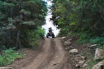 The Patton ATV Trail is located up Manti Canyon. The staging area for the trail is approx 2.9 miles up the canyon. You will see a small sign on the main canyon road marked Patton Trail. The staging area offers plenty of parking, pit toilets and a detailed map of the trail. There are several ATV trails offered up the canyon and they all eventually lead to the valley below or connect to one another. When we road the Patton Trail we actually started on Burnt Hill Road which is another trail that links to the Patton Trail. The pictures of the trail are us headed down to the staging area.
Sand Hollow Reservoir ATV Area
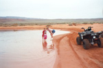 While vacationing in the St George area the family and I decided to take a day a visit to the new Sand Hollow Reservoir. Hearing about the 15,000 acre stretch of red sand dunes, we made sure we had are four wheelers in tow. The dunes are on the south side of the reservoir. When you arrive at the dunes don't be deceived by narrow appearance of the dunes. When you crest the first hill you will discover the dunes go on and on. When riding be sure to be prepared for the environment. We found as we crested each hill there was a bigger a better dune further out. It didn't take long before you were several miles away from the staging area.